
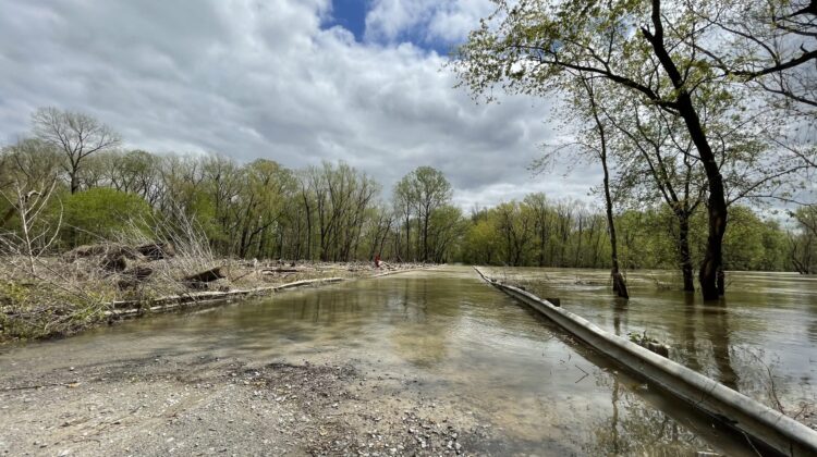

Last week the bean fields on Centennial Island and much of Reverie Island were inaccessible due to annual river flooding.
The river crested at 1 a.m. Thursday, April 8 at 31.17 feet, according to the U.S. Army Corps of Engineers’ gauge at Osceola, Ark. This is considered a moderate flood stage.
By Wednesday evening, the river had fallen to 23.51 feet. Flood stage is 28 feet.

Flooding is nothing new for those who know the islands, though not everyone realizes there are parts of Tennessee across the river.
Tipton County is the only county in state with land on the west side of the Mississippi River, thanks to the river’s sudden and violent change of course on March 7, 1876.
The course change meant the bodies of land were closer to Arkansas than Tennessee, but in 1918 the supreme court ruled the land remained the property of Tennessee.
Two generations ago there were hundreds of residents on the islands as well as stores and businesses. Today, Reverie (Island 35) and Centennial (Island 37) have fewer than 10 inhabitants combined, but are still farmed and hunted.


Leave a Reply